Point Bonita Lighthouse
Photo Gallery


About Point Bonita Lighthouse in Sausalito, California
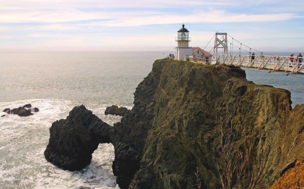
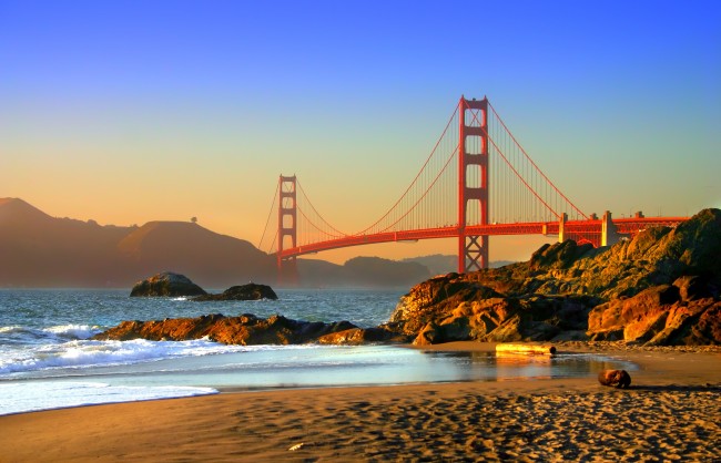
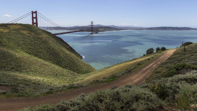
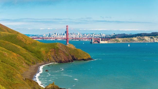
Point Bonita Lighthouse is located on a rocky point on the north side of the entrance to San Francisco Bay, known as the “Golden Gate”.
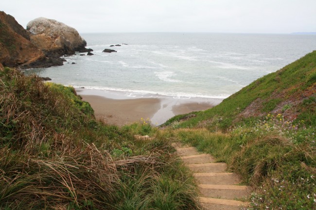
There is no beach access from this point, but there are views of picturesque (but inaccessible) coves and beaches below the point. On a clear day the views extend much further to the city of San Francisco and the Golden Gate Bridge about three miles away.
The lighthouse light is still actively used to warn approaching ships, but during the day anyone can visit and walk around the outside of it (entry into the building itself is not allowed).
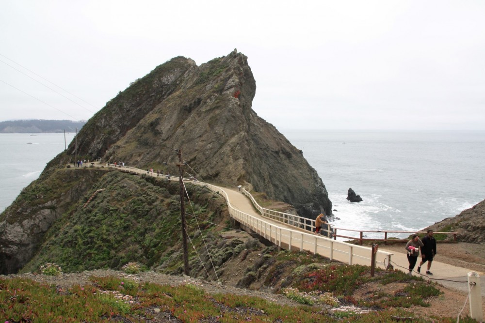
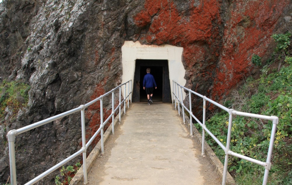
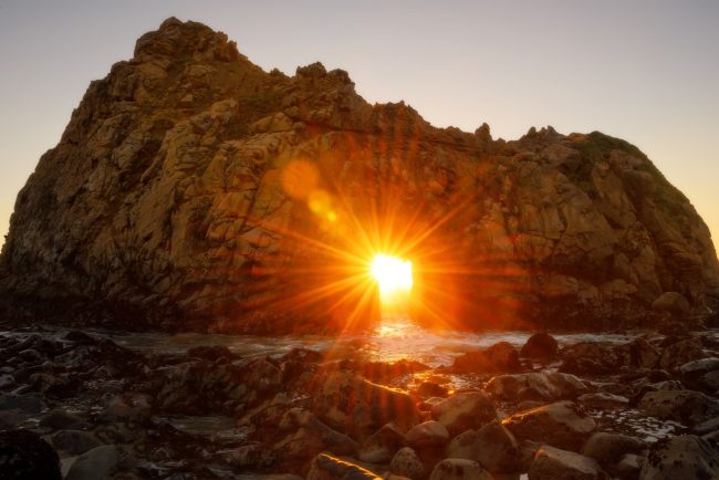
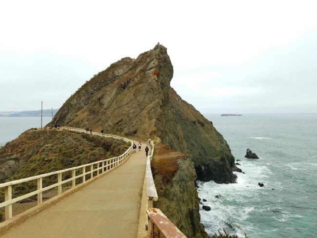
Getting to the lighthouse is half the fun. It requires a half-mile hike on a paved and dirt path which is steep in places and follows the edge of sheer cliffs. Along the way it passes through a tunnel in the rock and then culminates with a metal footbridge spanning the last gap to the lighthouse. From the viewpoint just before the bridge it is possible to see the Point Bonita Arch directly below the lighthouse.
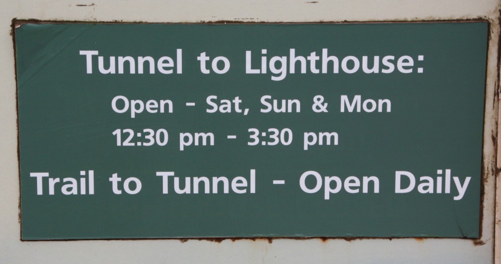
Unfortunately the tunnel to the point is only open Saturdays, Sundays and Mondays from 12:30 p.m. to 3:30 p.m. so plan your trip accordingly. It is still possible to see and photograph the lighthouse from the headlands outside of the trail, but it’s worth timing your visit to hike to the point if possible. Bring warm clothes as it is usually breezy and cool (if not downright cold) out at this location.
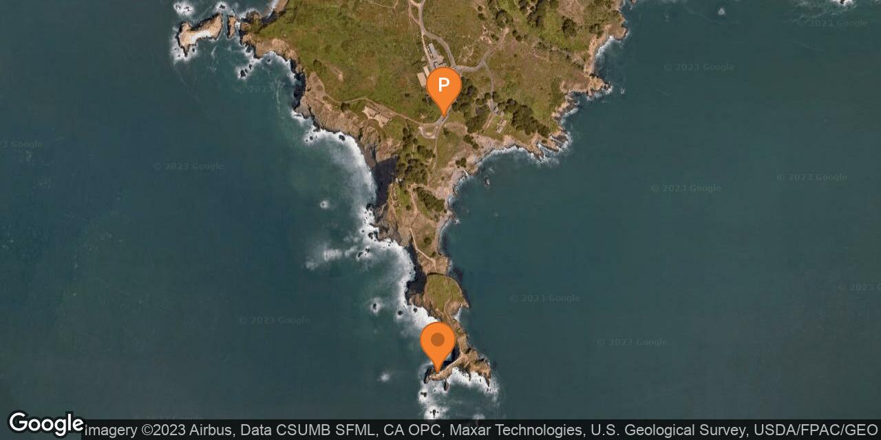
Parking spaces next to the trailhead are scarce with just 10 available spots. If they are taken look for parking at nearby Battery Alexander or find a dirt space way off the paved road outside the Point Bonita YMCA building. Heed all parking signs as they do issue citations in this area.
Bikes and dogs are not allowed on the trail to the lighthouse. Battery Mendell and Battery Wallace are both nearby the Point Bonita parking area and the latter has picnic facilities.
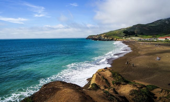
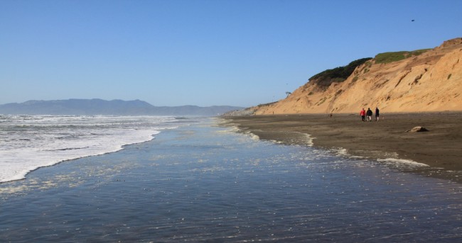
South Rodeo Beach is nearby if you want to visit an excellent sandy beach.
- Address
- Field Rd & Conzelman Rd
Sausalito, CA 94965 - Phone
- (415) 331-1540
- Park Name
- Golden Gate National Recreation Area
- Other Names
- Battery Mendell, Battery Wallace, Seal Rock
- Owner
- National Park
- Pet Details
- No dogs allowed
- Fees
- No fee for parking or lighthouse visitation
- Activities
- Hiking, Sightseeing, Photography
- Amenities
- Lighthouse, Rock Arch, Trails, Tunnel, Footbridge, Restrooms, Military Structures, Picnic Tables, Viewpoint, Cell Phone Tour
 50°F
50°FNearby Beaches
South Rodeo Beach
0.6 miles away
South Rodeo Beach is a small beach in a secluded cove south of Rodeo Beach in the Marin Headlands. It...
Rodeo Beach
1 miles away
Rodeo Beach is a wide pebble beach on the sand spit that separates Rodeo Lagoon from Rodeo Cove on...

Black Sands Beach
1.1 miles away
Black Sands Beach is a south-facing dark sand beach below the Marin Headlands in Golden Gate National Recreation Area....
Nearby Attractions


Nearby Lodging
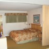
Marin Headlands Hostel
0.9 miles away
With your choice of private rooms, family rooms or dorms, the Marin Headlands Hostel supplies space for upwards of...
Seal Rock Inn
2.4 miles away
Just blocks away from some of San Francisco’s most noted sites and attractions, Seal Rock Inn provides a unique,...
Related Articles
Reviews
There are no reviews yet. Be the first one to write one.