9 Shipwrecks in California You Can See
California has had its fair share of shipping disasters over the years. Many of the ships hit rocks offshore and sank deep enough that only brave scuba divers can see the wreckage. Others, however, were stranded onshore or drifted ashore before they succumbed to the sea. The best time to view shipwrecks is at very low tides (minus tides) so check tide tables before you head out. Below is a list of the ships that can still be seen along the California Coast.
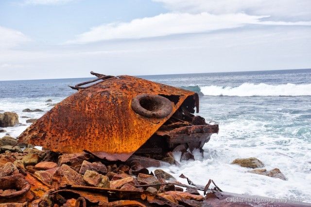
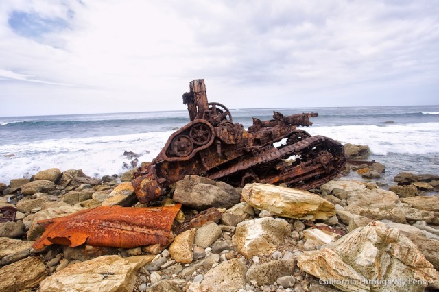
1. SS Dominator, Palos Verdes Peninsula, LA County
The Dominator was a freighter that hit the Palos Verdes Peninsula on a foggy day in 1961. It requires a hike along a rocky shoreline to see this one, but it’s worth the effort. There’s a lot left of this ship to see and it is usually well above the water line (avoid high tide). To see this rusting hulk, start at Lunada Bay and walk north to Palos Verdes Point which is just under a half mile away. An alternate route is to walk south from the beach access at Palos Verdes Estates Shoreline Preserve, a distance of about three-quarter mile.
 Josh McNair, CaliforniaThroughMyLens.com
 Josh McNair, CaliforniaThroughMyLense.com
2. The Lyman A. Stewart and Frank H. Buck, San Francisco
Both these ships ran aground near Lands End in San Francisco, the former in 1922 and the latter in 1938. The wrecks were destroyed using dynamite soon after the Buck sank, but small parts of the ships are still visible from the Coastal Trail south of Mile Rock Beach at Lands End. Nearby a rusty piece of another shipwreck, the Ohian which sank in 1936, can be seen just north of Point Lobos and the Sutro Baths. It’s best to visit each of these shipwrecks at low tide when more of the rusted metal is poking up out of the water.
 The Frank H. Buck steam engine seen at low tide.
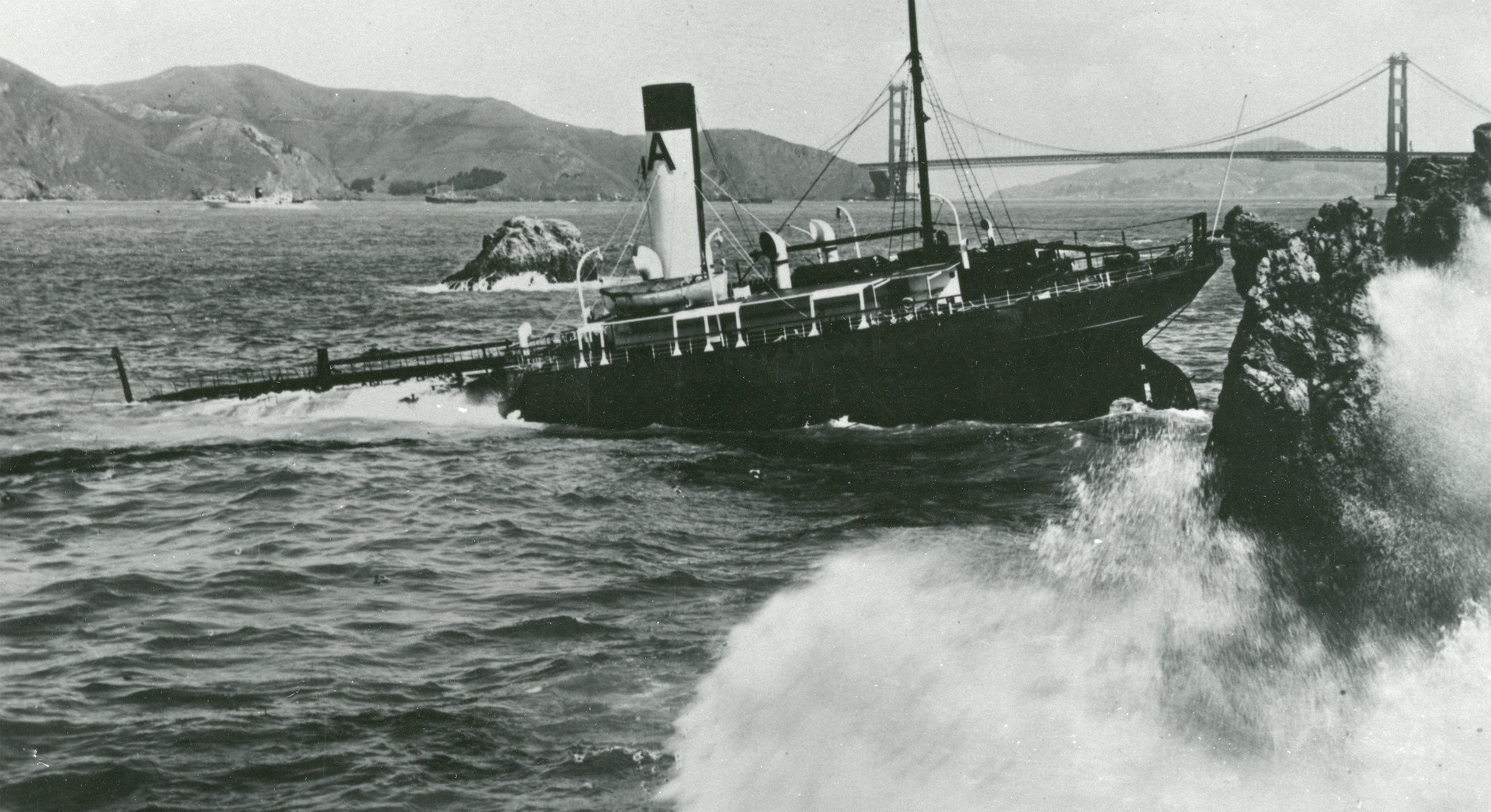 The Frank H. Buck as seen in 1938. Photo: NPS.
3. SS Monte Carlo, Coronado Island, San Diego County
This impressive shipwreck at Coronado Shores Beach near San Diego is worth waiting for a very low tide in the winter to see. The history and ironic fate of the Monte Carlo makes it even more worthy. It started as an oil tanker in the early 1920s and was later converted to a casino to take advantage of a loop hole that allowed gambling and prostitution as long as it was moored in international waters outside a three mile boundary from the shoreline. On New Year’s Day in 1937 a storm ripped this heavy concrete ship free of the anchor and blew it onto Coronado Island. Since it was an illegal ship on the US shoreline no one claimed ownership and there it stayed. Shifting sand often covers most of the ship, but when the sand is removed by storms and the tide is low, a large portion of this ship can still be seen. CNN had a report on the Coronado shipwreck when was exposed in February 2016.
 SS Monte Carlo. Photo: Wikipedia.
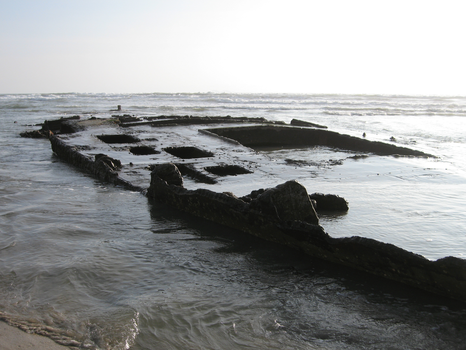
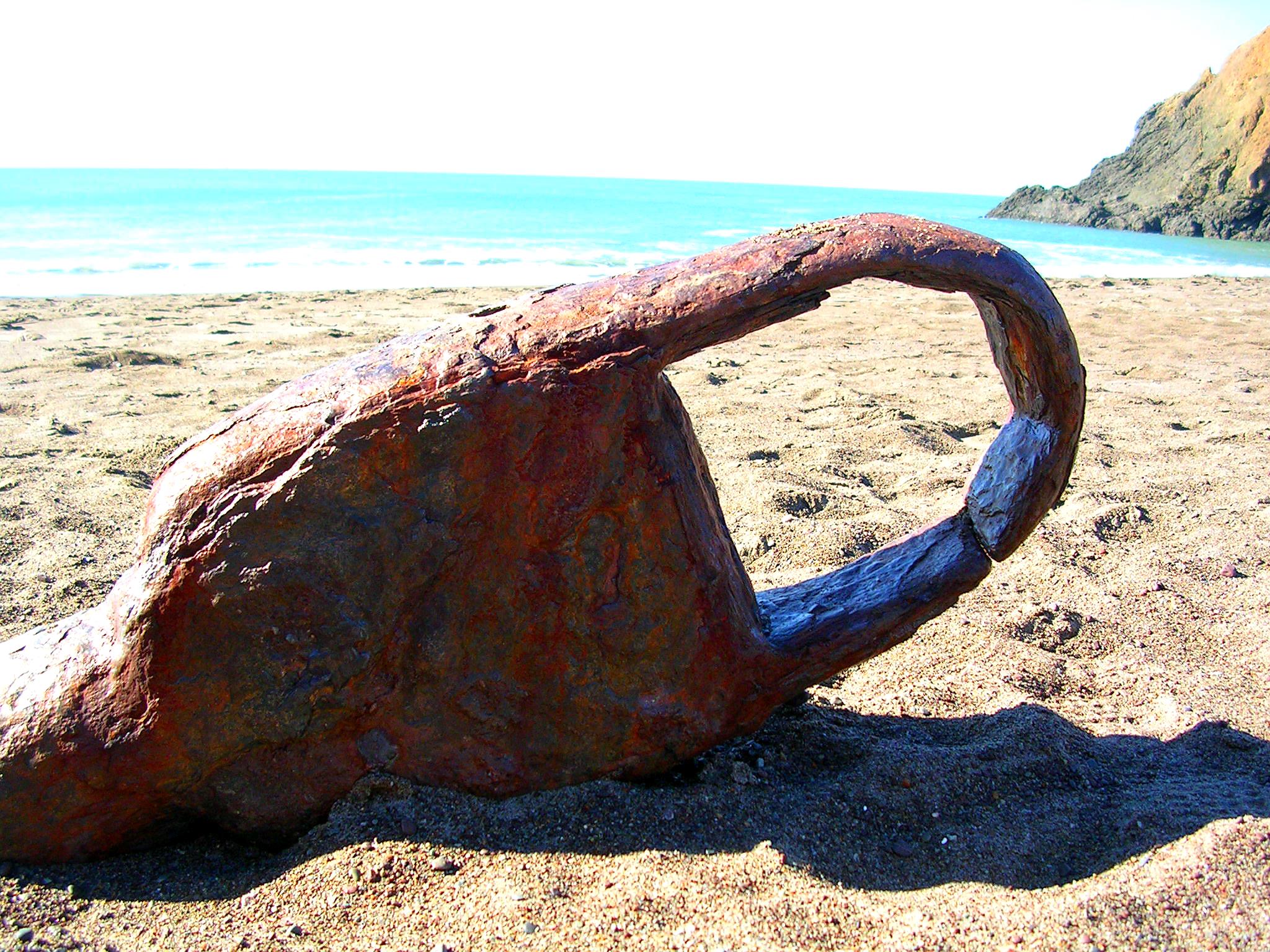
4. SS Tennessee, Mill Valley, Marin County
Many ships have run aground by missing the entrance to San Francisco Bay in fog. One of the earliest was the SS Tennessee which turned into Tennessee Cove in 1853. The passenger ship was beached on Tennessee Beach and everyone was saved (along with 14 chests of gold) , but the ship was not. When the tide is out it is possible to see parts of the rusting engine protruding from the sand. Look for a couple large bars with loops on the end sticking out at an angle.
 SS Tennessee. Photo: Bill Wagner.
5. La Jenelle, Oxnard, Ventura County
The La Jenelle was a 400-foot long cruise liner that was completed in 1931. By 1970 the current owners were trying to find a buyer when a storm pushed her ashore at the south end of Silver Stand Beach in Oxnard. The beached ship sat in a listed position until the US Navy cut the top off the ship and filled it with huge rocks to form an extension of the Port of Hueneme breakwater. It is possible to walk out onto the ship from La Jenelle Beach and see rusting metal parts, and even ceramic tile on interior walls of the old craft. More can be seen at lower tides.
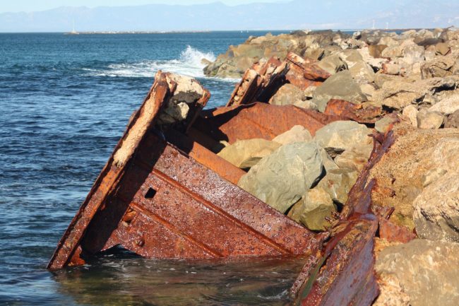 Rusting parts of the La Jenelle Shipwreck
6. SS Palo Alto, Aptos, Santa Cruz County
The SS Palo Alto was a tanker ship built out of concrete for use during World War I. It was completed after the war and sat unused on San Francisco Bay for a decade until it was towed out to Seacliff State Beach and purposefully sunk in shallow water in 1929. A wooden pier was built between the beach and the ship and for a couple years it was used as an amusement venue. Eventually the ship became unusable even as a fishing so it was closed off to the public. It’s still possible to see the remains of the ship at the end of the Seacliff Pier where birds make it home.
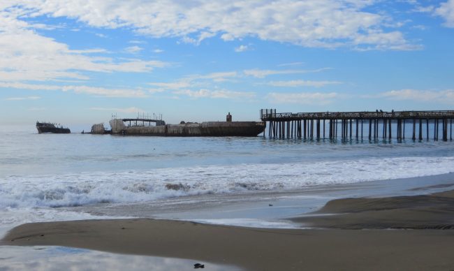 Palo Alto Concrete Ship
7. USS Milwaukee, Samoa, Humboldt County
In January 1917, the USS Milwaukee, a Navy cruiser, was sent to rescue a Navy submarine that was beached on the Samoa shore near Eureka. The ship was overcome by the wind and waves close to shore and became beached itself. The crew was saved but the ship was not. Most of the ship was removed for scrap metal, but some remains. Visit Samoa Beach at a low minus tide and you’ll find rusting parts of the ship sticking up out of the water. It is located near the Milwaukee Memorial at the intersection of New Navy Base Road and Samoa Pulp Lane.
 During a minus tide the Milwaukee is sometimes visible. Photo: Kathleen Cameron
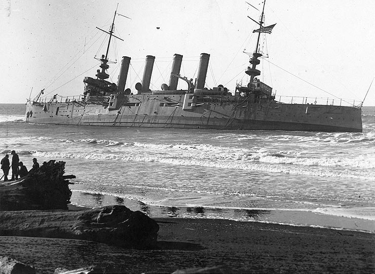 Milwaukee beached at Eureka, California, in January 1917.
8. Barge, Salinas River National Wildlife Refuge, Monterey County
This little-known barge was blown ashore at a remote beach on Monterey Bay in a 1983 storm. The owners tried to remove it but were unsuccessful. Since the barge didn’t contain any fuel, it was not considered an environmental hazard and was left to rust. It’s still visible on the beach at any tide, but at low tides people climb right onto it. The deck is rusting away and it’s possible to step through it in places so getting on the barge is not advised. You can find it by walking north on the beach from the access at Salinas River National Wildlife Refuge. It’s about a 1.5 mile total walk from the trailhead to the barge.
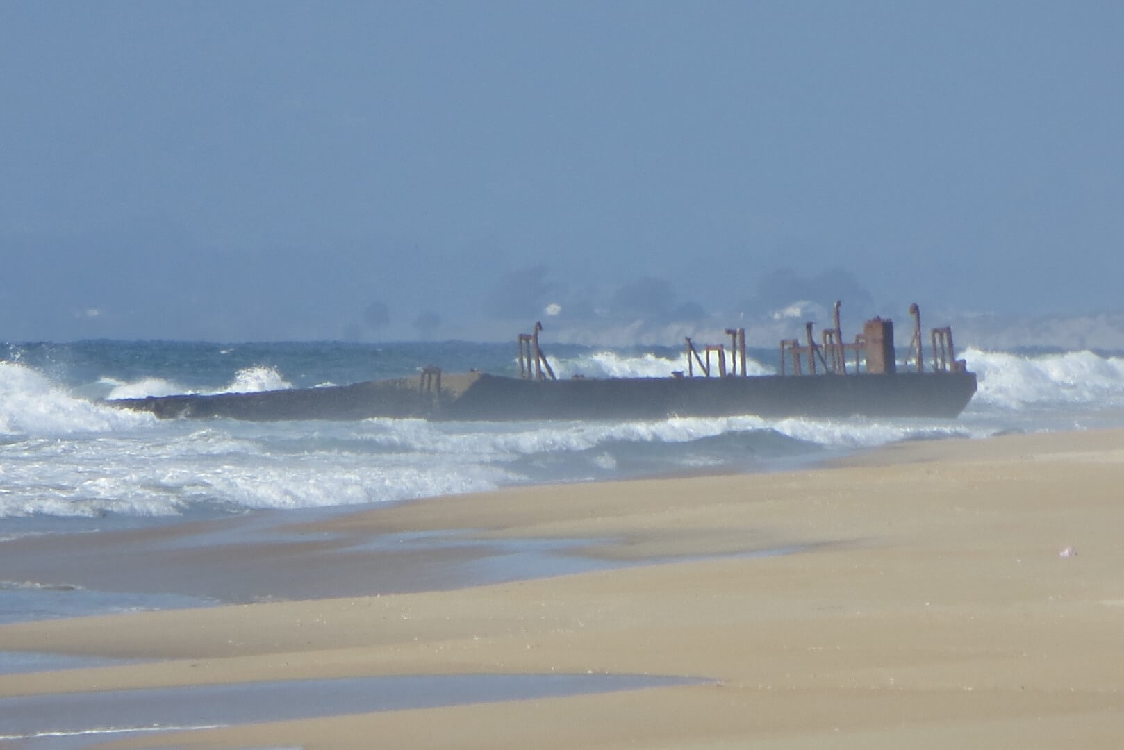 “The Barge” during high tide.
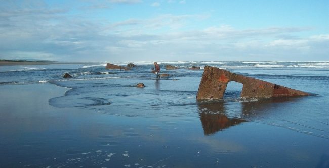
9. King Philip, San Francisco
The King Philip was a clipper ship that drifted ashore and was ripped apart by the waves on Ocean Beach in San Francisco in January of 1878. When it is exposed, this shipwreck is considered the best-preserved of the 200+ ships that have wrecked near San Francisco. Shifting sands usually cover this ship, but at times (such as in 1984 and 2011) large portions of the wooden hull have appeared at low tides. If you want to see if it is visible, find an upcoming minus tide and then use a mapping service on your phone to navigate to these coordinates 37.751517, -122.509846.
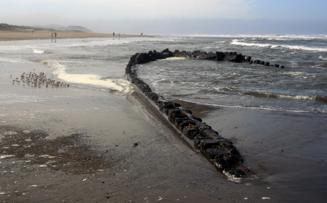 King Philip Shipwreck. Photo by Mila Zinkova
See where these shipwrecks are located – Map of California Shipwrecks.
Read about the Most Unique Beaches in California