California Coastal National Monument
California Coastal National Monument was originally created to protect the many islands, rocks, pinnacles, and exposed reefs that had not been appropriated or reserved in other ways. This includes over 20,000 named and unnamed places off the coast within 12 nautical miles. President Bill Clinton established the national monument in the year 2000 and it has been expanded a couple times since then. California Coastal National Monument is managed by the BLM rather than the National Park Service like most national monuments. Finding information on California Coastal National Monument is difficult so we wanted to create a map and share it.
Most of this national monument is visible from the shoreline but is not easily accessible (the offshore places are off-limits to visitation anyway). However, many of the lands added to the national monument in recent years can be visited. See the map of the beaches above and the list of each area below.
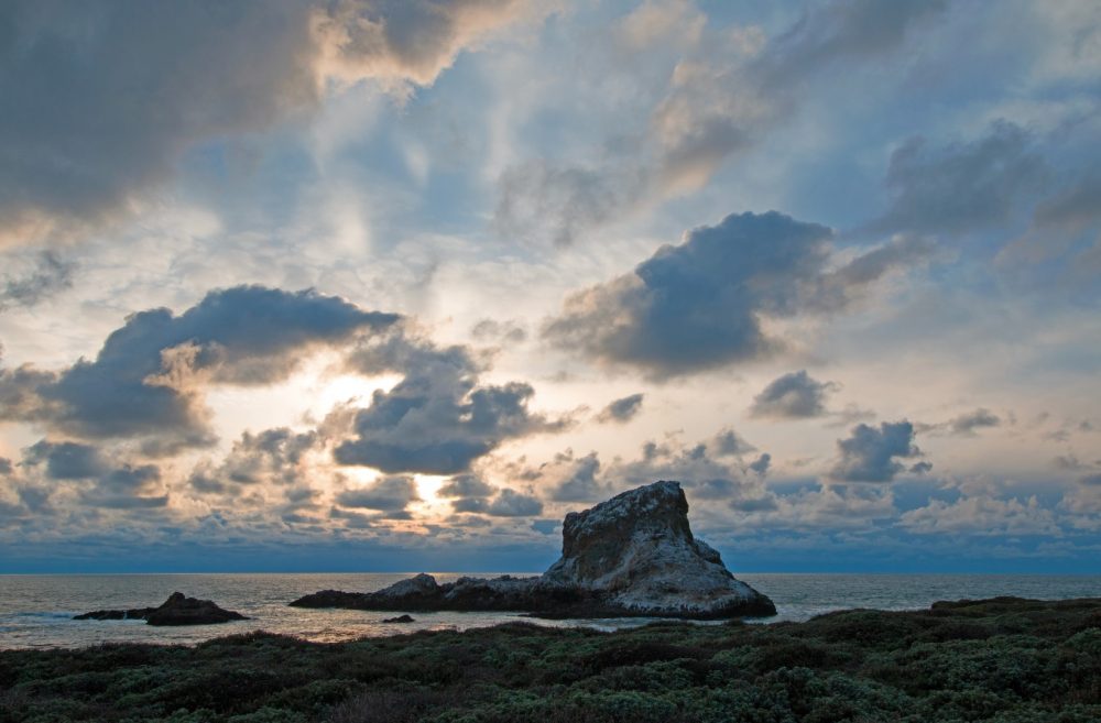 The Haystack at Point Piedras Blancas
California’s Rocks and Islands
With 20,000 locations there are too many to list of course, but some are better-known and easy to photograph. Just drive coastal Highway 1 and you’ll see many.
Stornetta Public Lands, Point Arena
The Point Arena Stornetta Public Lands includes property all around the Point Arena Lighthouse. To the north this includes the land and beach at the Garcia River Estuary. South of the lighthouse is comprised of rocks (including Sea Lion Rocks), several natural arches, and the beaches of Stornetta. President Obama added Stornetta to California Coastal National Monument in 2014. The rest of the areas listed below were added by him in 2016.
Orange County Rocks and Islands
The US Congress reserved these offshore rocks and islands in the 1930s for their scenic beauty and for potential public use as lighthouse locations. Now they are part of the national monument. They stretch from Dana Point Headlands up to Little Corona Del Mar. In between most of the rocks are at beaches in Laguna Beach.
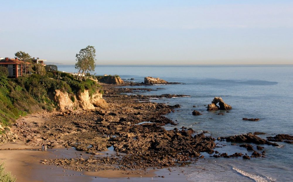 Arch Rock and other rocks at Little Corona Del Mar Beach
Piedras Blancas
This portion of the California Coastal National Monument is at Point Piedras Blancas, site of the lighthouse at Piedras Blancas Light Station Outstanding Natural Area. Several visible rocks, such as the Haystack, De La Cruz Rock, and Boot and Slipper (just offshore from the Elephant Seal Rookery), are part of the monument.
Cotoni-Coast Dairies Properties
This area north of Santa Cruz includes many beaches and old ranch properties. It is the inland portion of the public property (east of Highway 1) that was added to the national monument in 2017. The waterfront properties are still owned and managed by the state of California. See our map of Coast Dairies State Park to see the beaches near the Cotoni-Coast Dairies Properties.
Lost Coast Headlands
The area of the newly expanded national monument, which has been generically named the “Lost Coast Headlands,” is a hidden gem. The Lost Coast is a vast area in northern Mendocino County and southern Humboldt County, and this new property is a tiny fraction of the whole. That said, it needs to be discovered! Two beaches and trails make up the “headlands” – Guthrie Creek Beach and Fleener Creek Beach. Both have a short steep hike down to the shore from well-signed trailheads on a scenic dead-end road near the town of Ferndale.
Waluplh-Lighthouse Ranch
This small property is the former site of a lighthouse and other buildings perched high above the beach at Table Bluff County Park near the small town of Loleta in Humboldt County. There is currently nothing to see at this location, but it has amazing views of the ocean and Humboldt Bay when it’s not foggy.
Trinidad Head
Trinidad Head is a tall peninsula next to Trinidad State Beach in the Northern California coastal town of Trinidad. The head has hiking trails and a small beach just below it. On the far side of Trinidad head facing the ocean there’s a small hard-to-see lighthouse protecting mariners from the rocky coast in this often foggy locale.
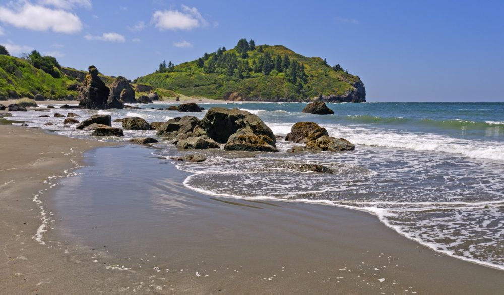 Trinidad Head from the north