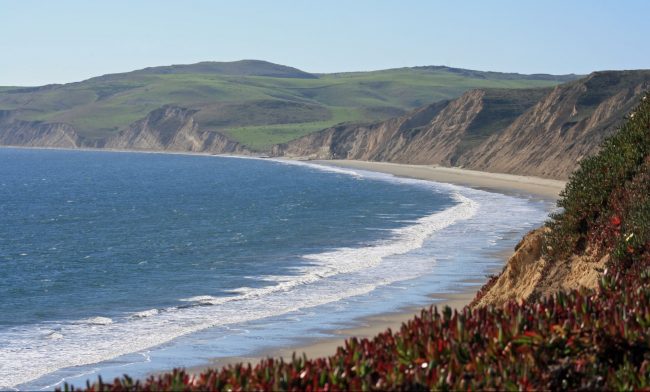
Point Reyes National Seashore in western Marin County has over 30 named beaches. With that many beaches it’s hard to decide where to go. Some of the beaches are only accessible with a boat or kayak on Tomales Bay. Others are a long hike away from a visitor center or trailhead. We have highlighted the best beaches on the Point Reyes Peninsula that are accessible from a nearby parking lot or just a short day hike.
Even though it’s not far as the crow flies from the San Francisco Bay Area and even Sonoma County, it takes a long time to drive out here on twisty rural roads so plan for an all day adventure. Restaurants, stores, and lodging can be found in the nearby small towns of Olema, Inverness, and Point Reyes Station. For the rest of the beaches in Point Reyes National Seashore see those three city pages.
Drakes Beach on the protected side of Point Reyes Peninsula
Point Reyes can be cool and damp at any time of the year so dress appropriately when you visit.
Beaches on this map
-
Palomarin Beach
Palomarin Beach is the southernmost beach along the Pacific side of Point Reyes National Seashore. At low tides, there are tide pools exposed, but at high tides this rocky beach […]
-
Limantour Beach
Limantour Beach is a south-facing beach on a sand spit between Drakes Bay and the Limantour Estero esturary. Limantour Beach has a nice large parking lot near the beach. Trails […]
-
Drakes Beach
Drakes Beach is a remote beach in Point Reyes National Seashore that requires a long scenic drive to reach. There used to be a cafe at the beach (Drake’s Beach […]
-
Chimney Rock on Point Reyes
Chimney Rock is a prominent point that protects Drakes Bay in Point Reyes National Seashore from winds and waves coming off the Pacific. The parking lot at Chimney Rock gives […]
-
Point Reyes North Beach
North Beach at Point Reyes Beach is the northern access point to an 11-mile long beach on the west side of Point Reyes National Seashore. Beachcombing is probably the biggest […]
-
Point Reyes South Beach
South Beach is the southern access to Point Reyes Beach, an 11-mile long strand nicknamed “The Great Beach” in Point Reyes National Seashore. This vast expanse of shoreline is excellent for beachcombing. Walk […]
-
Abbotts Lagoon Beach
Abbotts Lagoon Beach is along the rugged western shoreline of Point Reyes National Seashore. The beach is backed by huge sandy dunes and a couple large lagoons. To get here […]
-
Kehoe Beach
Kehoe Beach is a secluded beach along the western face of Point Reyes National Seashore. You must hike down a valley on a dirt trail for a little over a […]
-
McClures Beach
McClures Beach is a remote beach on the northwest coastline of Point Reyes National Seashore. It is the last easy access beach on the western side of Tomales Point (Driftwood […]
-
Marshall Beach
Marshall Beach is on Tomales Bay in the northern part of Point Reyes National Seashore. Access to Marshall Beach is either by water or by trail. Visitors frequently boat-in to […]
-
Point Reyes Lighthouse
Point Reyes Lighthouse is perched on a ledge at the Point at the farthest distance from the park entrance. Unfortunately there is no beach access from the lighthouse, but Point […]
-
Drakes Estero
Drakes Estero is a large body of water in the heart of Point Reyes National Seashore. This shallow saltwater bay is made up of tidal flats, sand bars, and birding […]
Hotels on this map
-
Point Reyes Hostel
The Point Reyes Hostel is on the site of an historic ranch on Drakes Bay in Point Reyes National Seashore. The old ranch buildings were used to create a hostel […]
Attractions on this map
-
Bear Valley Visitors Center
Bear Valley Visitor Center is a great place to start for any visit to Point Reyes National Seashore. It’s located just outside the tiny town of Olema and just three […]
Other locations on this map
-
Inverness
-
Point Reyes Station
-
Olema