6 Amazing Bucket List Hikes On The California Coast
If there is a better form of exercise than going on a beautiful hike near the beach, we can’t think of what it could be. Between the pleasant weather and the stunning scenery, you may actually forget that you’re working hard and burning calories. We’ve previously listed some ideas for sunset hikes and trails that are under 5 miles. But when you’re ready to step up your hiking game and go on a once-in-a-lifetime adventure, check out these trails.
The Lost Coast
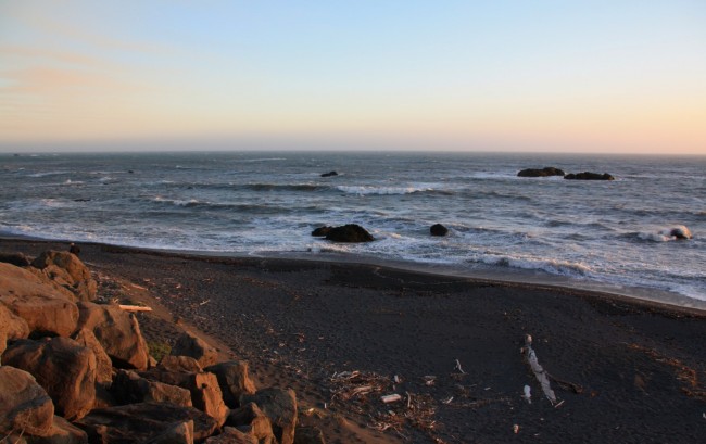
The Lost Coast Trail is definitely more of a backpacking adventure than a day hike. It spans from Mattole Beach to Black Sands Beach, about 24 miles. The path takes you through some of California’s most underdeveloped coastline, so it’s not an easy journey, although you don’t have to be a veteran hiker to attempt it. And if day hikes are your thing, then consider just hiking the trail and beach a few miles in from either end.
If you’re not up for hiking the 24 miles back, there’s a shuttle service that will take you from Black Sands Beach to Mattole (two hours driving time). To access the trail, take Exit 663 from US 101, turn right on Lower Bull Creek Flats Road, follow the road for 22 miles and turn west toward Petrolla. Turn west on Lighthouse Road and follow the signs.
Point Reyes National Seashore
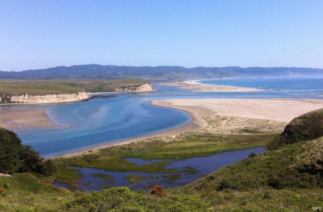
Just north of San Francisco, wrapping around Drakes Bay, the Point Reyes National Seashore offers several great trails for hiking. You can choose your own length here, and every path offers spectacular views and possible harbor seal sightings. The longer hikes lead to Santa Maria Beach, Sculptured Beach, Secret Beach, Kelham Beach, Arch Rock Beach, Wildcat Beach, and the gorgeous waterfall at Alamere Creek Beach.
To get there, Take San Antonio Road from US 101 just south of Petaluma. Turn left onto Point Reyes/Petaluma Road, drive for 11 miles, going over a bridge before turning right onto Sir Francis Drake Boulevard. Turn right onto US 1, then a quick left onto Bear Valley Road, taking the first left to the Visitors’ Center.
High Peaks – Balconies Cave Loop
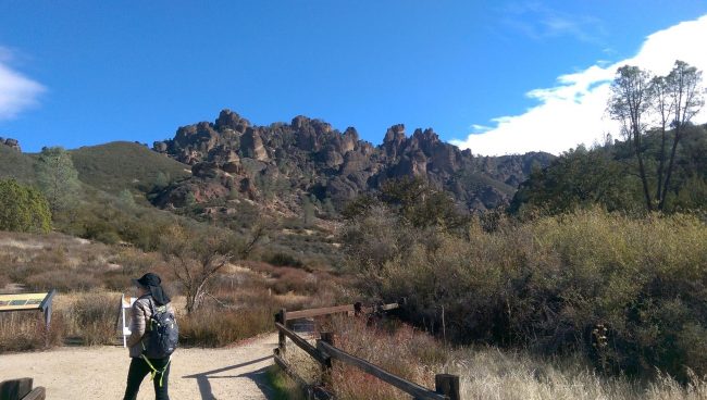
Pinnacles National Park is a beautiful place to hike. Located on the Central coast, it’s full of boulder-filled gorges and talus caves to explore. The High Peaks Trail is a nine mile loop through diverse landscapes. To reach the park, Take US 101 to Exit 281. Turn right at the end of the ramp, heading north on First Street, then take County Road G13 out of the city for 14 miles. Turn left onto Route 146, following the signs to the park.
Buckeye Trail
Located in the Silver Peak Wilderness area of Big Sur, the Buckeye Trail truly has views you have to see to believe. Rising above Highway 1, the 6.5 mile round trip trail ascends coastal canyons and ridges to panoramic vistas and a number of trail camps. To find this piece of paradise, take Highway 1 to a dirt parking area along the road about 5 miles north of the Ragged Point Inn. Look for the trail mileage sign at the trailhead.
Reservoir Canyon Trail
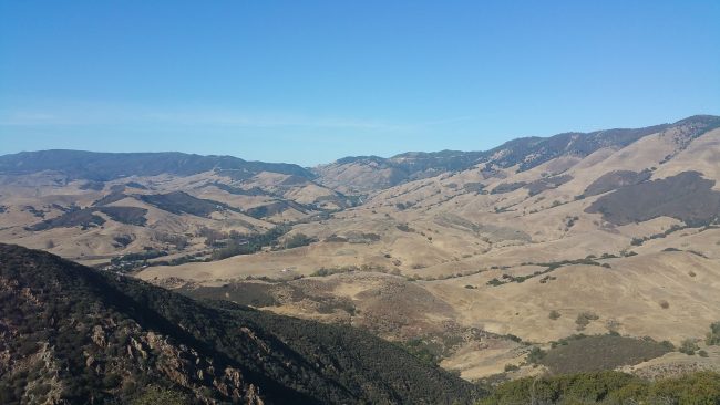
A word of caution: This trail should not be attempted by beginners. Located in the Santa Lucia foothills northeast of San Luis Obispo, the 5.5 mile round trip hike goes up 1,350 feet, and over 800 of those feel come in the final grueling mile. But if you manage to make it to the top, your reward will be panoramic views you’ll never forget.
To get here from San Luis Obispo, take US 101 north for two miles to Reservoir Canyon Road. Take a right and drive half a mile to the trailhead parking lot.
Paseo Miramar
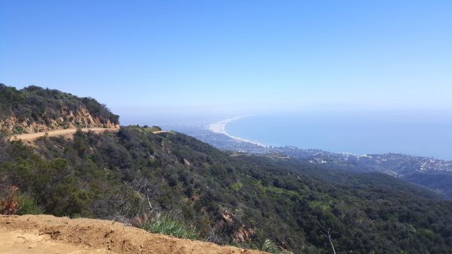
This seven mile hike takes you to a gorgeous lookout point high above Pacific Palisades in Los Angeles County. The views from along the trail include Santa Monica Bay, Downtown Los Angeles, and Catalina Island. At the end of the hike you’ll find a couple benches and an overlook that rivals any others in the Santa Monica Mountains. There are a few approaches to reaching the pinnacle, but they all add up to about seven miles, so there’s no “cheating the system.”