
The California Coastal Trail is an evolving thru-trail that follows the entire coastline of California as close to the ocean as possible. Throughout its 1200 miles it uses trails, roads, sidewalks, and of course beaches to get folks from the border with Mexico to Oregon. It changes over time as trails are added and other factors force walkers and backpackers to get on and off the beaches along their trek.
The portion of the California Coastal Trail in San Diego County is fairly straight forward and luckily includes a lot of beach walking. We won’t try to detail every step of the path here, but we can give you the gist of it and you can accomplish this massive trail by doing it in pieces if so desired.
Here are the segments of the CCT in San Diego County from south to north.
South Imperial Beach to Coronado Beach (Beach Walk)
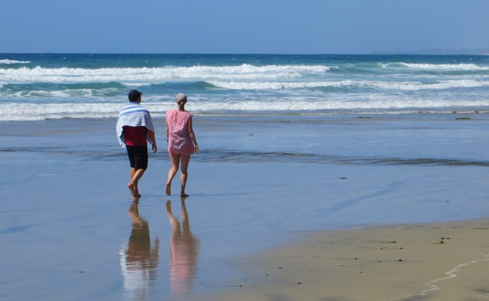
This segment starts north of the Tijuana River as it is usually too deep to cross (south of the river there’s a 1 mile beach walk starting at Border Field State Park). From just north of the river near South Imperial Beach you can walk on sand all the way to Coronado Beach for about 10 miles. Note that this passes through US Navy property north of Imperial Beach so heed any signs you encounter but from our experience they won’t hassle people walking at the water’s edge. From Coronado Beach the route gets complicated and requires a ferry ride to downtown San Diego.
San Diego to La Jolla (Streets & Beaches)
Due to San Diego Bay, the rugged cliffs of Point Loma, and large waterways at San Diego River and Mission Bay this segment is harder to describe. From the ferry landing in San Diego (Broadway Pier is easier) go north along N Harbor Dr. following sidewalks and paved bike paths that include The Embarcadero, Spanish Landing Trail, and Bessemer Path. These paths get you to Kellogg Beach from which you will cross over Point Loma to Sunset Cliffs Natural Park. Then you’ll walk along Sunset Cliffs Blvd and various other streets on the way to Ocean Beach (it is possible to walk a bluff trail from Santa Cruz Beach to Ocean Beach Pier). To get from Ocean Beach to South Mission Beach you need to cross over two large bridges, but after that it’s a pleasant beach walk up through Pacific Beach to the end near Tourmaline Surf Park.
La Jolla Coast Walk
The La Jolla segment starts at Linda Way Beach Access (just north of Tourmaline) and follows the closest streets to the ocean all the way to La Jolla Strand Beach. From there the California Coastal Trail is the same as the La Jolla Coast Walk which is on beaches and sandstone bluffs and a trail above La Jolla Caves. From there it’s a simple street walk to the next segment starting at La Jolla Shores.
La Jolla Shores to Oceanside Harbor (Beach Walk)
At low tide it is possible to walk on the sand for 26 miles from La Jolla Shores beach to Oceanside Harbor where the public beach ends. North of Oceanside the beaches are part of Navy Base Camp Pendleton and therefore off-limits. However a 26 mile sandy segment is pretty wonderful. This beach route takes you through Torrey Pines, Del Mar, Solana Beach, Encinitas, Carlsbad, and Oceanside. To do it you’ll need to cross over several waterways by going over adjacent bridges on sidewalks, but in all cases these are easy. This long section can be broken up in so many ways. See our California beaches map to find ways to do that. Also, remember that there are places where the shoreline is all water at high tide so consult tide tables before you go.
Additional information
Coastwalk California is the non-profit organization that pushes the evolution of the CCT. They have links and more details about the trail on their website.
Beaches on this list
-
Border Field State Park Beach
The beach at Border Field State Park is the southernmost beach in California. This beach starts at the Mexican border and continues north to the mouth of the Tijuana River. […]
-
Tijuana Slough National Wildlife Refuge
Tijuana Slough National Wildlife Refuge is part of Tijuana River National Estuarine Research Reserve, a large protected area of wetlands south of San Diego. The beach in Tijuana Slough National […]
-
South Imperial Beach
Imperial Beach continues south of Imperial Beach Boulevard all the way to the southern end of Seacoast Drive. South Imperial Beach is not as wide as the main Imperial Beach […]
-
Kellogg Beach
Kellogg Beach is a locals beach on the San Diego Bay side of Point Loma in San Diego. Depending on sand amounts this beach should span the two block waterfront […]
-
New Break Beach
New Break Beach is a hard to reach surfing spot in the Sunset Cliffs area of San Diego. This beach is narrow and probably all wet at high tide. Access […]
-
Santa Cruz Ave Beach
Santa Cruz Beach is a locals beach in the Ocean Beach area of San Diego. It is located at the west end of Santa Cruz Avenue where a long stairway […]
-
South Mission Beach
South Mission Beach is at the extreme south end of the Mission Beach Peninsula at the Mission Bay Channel Entrance. There is a grass park there with picnic tables, restrooms, […]
-
North Pacific Beach
North Pacific Beach is north of the Crystal Pier at Pacific Beach and south of Tourmaline Beach. This wide sandy beach located below a steep bluff in the Pacific Beach district […]
-
Tourmaline Surfing Park Beach
Tourmaline Beach is at a San Diego area surfers’ mecca called Tourmaline Surfing Park. This beach sits on the border of the Pacific Beach and La Jolla districts of San […]
-
Linda Way Beach Access
Linda Way Beach Access is below Sea Ridge Drive at the Linda Way intersection in southern La Jolla. The ramp and stairs at this location take you down to a […]
-
Calumet Park Beach
Calumet Park is a small neighborhood park in south La Jolla on Calumet Avenue just south of Midway Street. The beach below Calumet Park is rocky and lacks a nice […]
-
Camino De La Costa Beach Access
Camino De La Costa Beach Access is located on Camino de la Costa just north of Bird Rock in southern La Jolla. At a sharp bend in the road there […]
-
La Jolla Strand Beach
La Jolla Strand Beach is located along Neptune Place between Palomar Avenue and Gravilla Street in La Jolla. There are several stairs along Neptune Place in this area so you […]
-
South Beach of Del Mar
South Beach in Del Mar is best described as south of Powerhouse Park all the way to 6th Street at the north end of Torrey Pines State Beach. This beach is […]
-
Seascape Sur Beach
Seascape Sur Beach is a long sandy beach below the high bluffs in Solana Beach, CA. The gradual slope of the beach makes it wide at low tide and narrow […]
-
Boneyard Beach
Boneyard Beach is located below a very steep cliff between Swami’s Beach and D Street Beach in Encinitas, CA. Boneyards is a dry sandy beach at medium and low tides and […]
-
Terramar Beach
Terramar Beach is the narrow beach in front of the Carlsbad California community of Terramar. Technically this beach is part of South Carlsbad State Beach, but there are no signs […]
-
Carlsbad City Beach
Carlsbad City Beach, as it is known, is actually state property within Carlsbad State Park. This beach is located along Ocean Street with many different stairway accesses to the beach. […]
-
Oceanside Boulevard Beach
Oceanside Boulevard Beach is at Oceanside Blvd and Pacific Street in Oceanside, CA. The beach here is narrow and usually all wet at high tide. The beach entrance at this intersection […]
-
Oceanside Harbor Beach
Oceanside Harbor Beach is a wide sandy beach in front of Oceanside’s harbor. The beach is boxed in by two rock jetties at both ends which seems to hold in […]